Repeated Cities U.S.
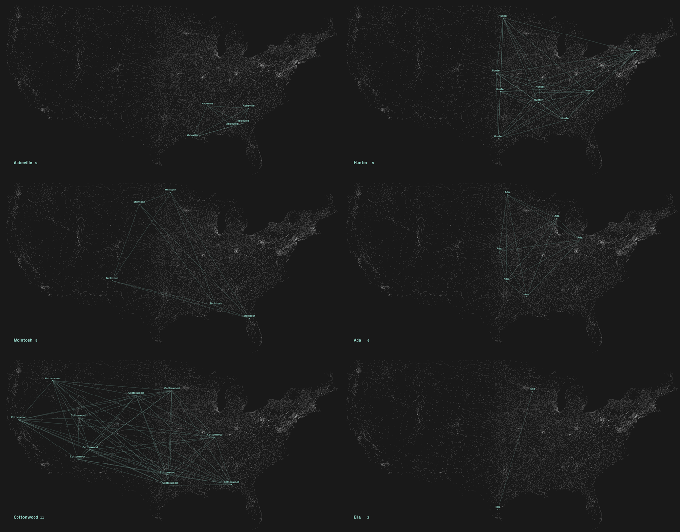
Data is a vehicle for communication. The transformation of data into visual representations is a process that lends itself to answer questions, reveal patterns, create meaning and tell stories. This computer application programmed using Processing*, visualizes a dataset containing the geographic location of cities and towns in the United States. The program runs alphabetically through almost 20,000 rows of data creating networks that connect cities and towns with the same name across the country. This macro view of homonymous cities and towns across the U.S. is the beginning of an inquiry on the origin and meaning of the names, the potentials of computer coding and interactive data visualization.
*Processing is an open-source coding environment for the visual arts.
This visualization excludes the non-contiguous states of Alaska and Hawaii and all off-shore United States territories.
Source of Data: National Atlas of the United States, 2014. Global Map: Cities and Towns of the United States [dataset].
